Select a Date to Display UHR ASCAT Coastal Images |
Click the coastal zone to view images for that coastline/regionIce Sigma0 available for Alaska and Great Lakes regions when applicable.Current Zone Selected: East Coast
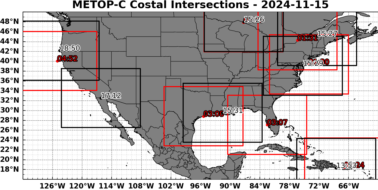
Estimated Coastal Intersections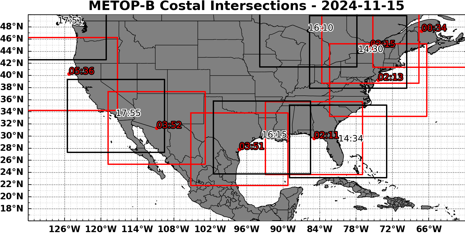
Notes (click to expand) |
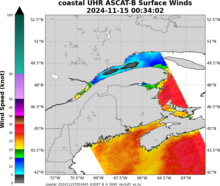
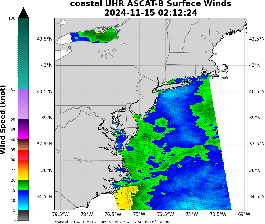
ASCAT-B - Ascending |
ASCAT-B - Descending0 image(s) |
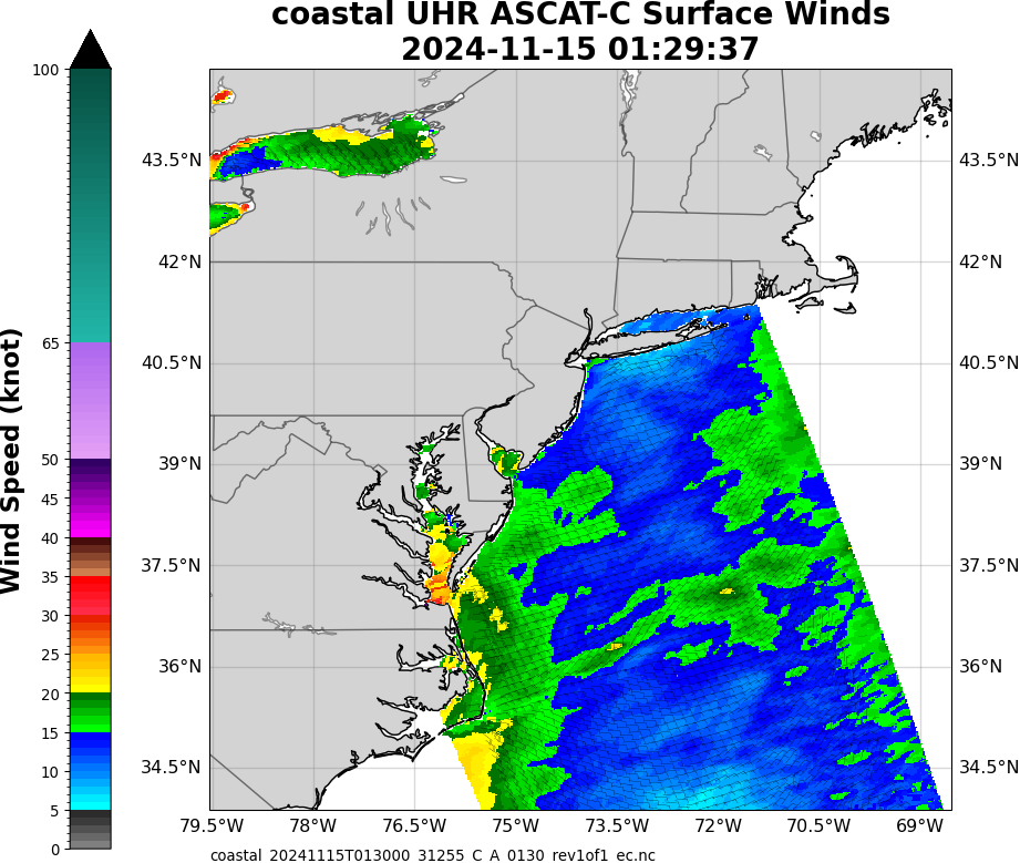
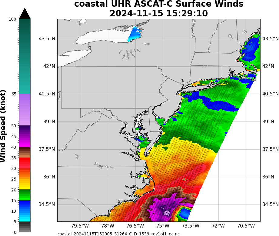
ASCAT-C - Ascending1 image(s) |
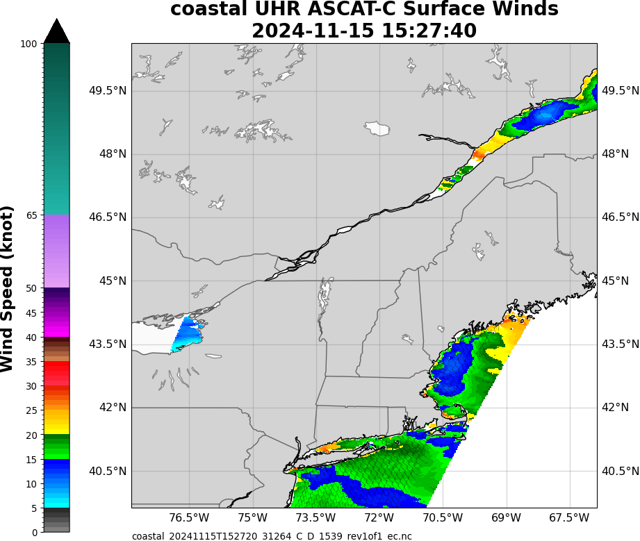
ASCAT-C - Descending |
||
|
Data, algorithms, and images presented on STAR websites are intended for experimental use only and are not supported on an operational basis. Disclaimer details
Dept. of Commerce • NOAA • NESDIS • Privacy Policy • Disclaimers • Information Quality • Accessibility • Search • Customer Survey |
|||